


Time has Come
Saturday 20 Aug 2011 The wind charts have finally settled with beautiful glassy seas for Monday's huge 25ft+ peak in W Cape, but fresh NW winds Sunday as surf builds towards 20'+, writes Spike as he keeps a twitching eye on Wavescape Ocean Watch.
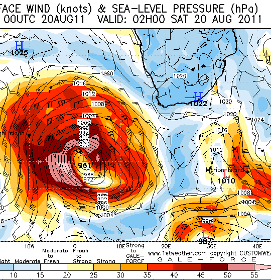
Again, we've swung back to a bit of a front on Saturday, going strong NW overnight into Sunday (frontal weather, heavy driving rainsqualls by 5am early Sunday all morning), staying fresh and ragged NW all day, strong at times and a bit wild as the swell really starts to crank through at a solid 20 feet and rising to 25' at 16 second intervals (that is HARDCORE deep ocean power), with some serious waves. Still looks a little wild and woolly, and the pick of the conditions seems to be Monday morning early, when the storm swell is at its cleanest, and biggest, with serious 30 footers not out of the question.
Loverly light SE winds greet the tow ous and other mullets set to test their steely resolve against the formible might of Neptunes elite storm drung troops. Expect EPIC big wave surf all Monday morning, when the swell is at its most gigantic. Then the SE is due to go fresh and it may get a bit ragged, if not downright dan-ger-oos BUT the thing is, yet ANOTHER front arrives late Monday into early Tuesday (more heavy heavy rain) and the SE may just puff out and die before - making Monday a dream call - Eddie would go.