Shiver me Britches!
Tuesday 30 October 2018 Carnage has been spreading up the East Coast today as a howling SW gale furiously manifests a 10 metre swell and dangerous seas. Batten the hatches, if you haven't already, writes Spike.

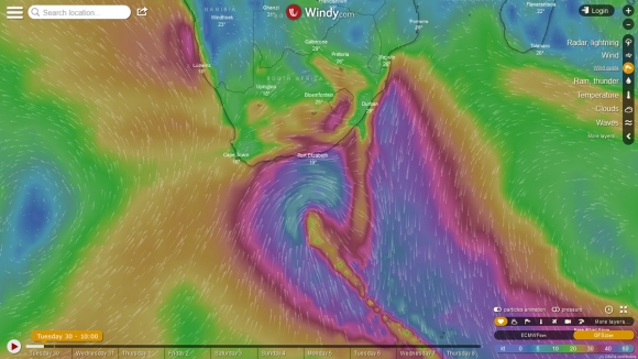
1000 MILE STARE: Storm wind over a vast distance. There's your 10m swell. Photo Windy
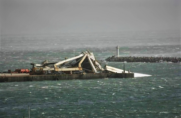
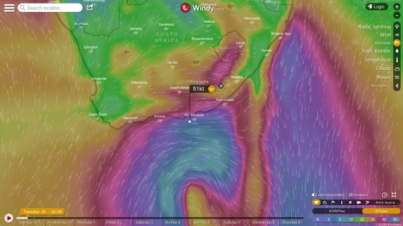
Already a crane in Port Elizabeth has been blown over by the wind, which exploded upon the Windy City at about 12 this morning. A powerful low pressure system lies behind the carnage, with a central pressure of 985 millibars just 360 nautical miles from the PE coast when the wind hit.
Along the western flank of the storm, the sea is a heaving wind-whipped mess along a gigantic 1,000 nautical mile channel that is funnelling the swell straight at an area between St Francis and Coffee Bay.
The swell produced within this long fetch reaches 10 metres at 14 seconds, while the surf along this stretch, and beyond, was already smashing through this morning at about five metres, but building and becoming absolutely ginormous all afternoon, reaching 8m+ this arvi.

CRANED NECK: A crane in PE lies in a crumpled heap from the 50kt wind. Photo Jason Ribbink
So if you haven’t battened the hatches, you better do so asap. The wind is just hitting Durban around about now, between 2pm and 3pm, with big swell spreading up the coast.
Already today, the WaveWatch III model calls the swell along the open coast by Cape Recife 27 feet at 14 seconds. By tomorrow, the surf is going to be gangbusters, with crisp offshores and ridiculous 10 foot SSW groundswell (fading all day) lining up the points all over the show, although only reaching the South Coast of KZN overnight, where it will be solid 6-8 foot perhaps, lank smaller.
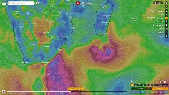
Also, a head’s up that the Cell C Goodwave looks like it could be lining up for a good day next week Monday or Tuesday. In the wake of this buster passing through and moving on, a high pressure slips into its place and interfaces with a low pressure cell over southern Madagascar or just off it.

BOOM GATE: Fierce winds with gusts to 50kts+ smashed through PE earlier. Photo Windy
This creates a long and strong fetch of strong (35kts) east wind by early Sunday next week, and that swell arrives in Durban on Monday in the form of a 2.4m @ 10 seconds East swell (100 degrees) and a fresh SSW buster blowing all day. Despite a strong NE the day before on the Sunday, the west should clean things up a lot, and it looks pretty good.
If not, there is always Tuesday, which is looking peachy too, with the tail of the swell holding nicely at 2.2m @ 11 seconds or so, maybe even a bit punchier at first.
Lekker!

EAST BEAST: This system could just be the ticket for the Goodwave next Monday or Tuesday


