


Nature's Fury
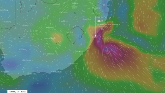
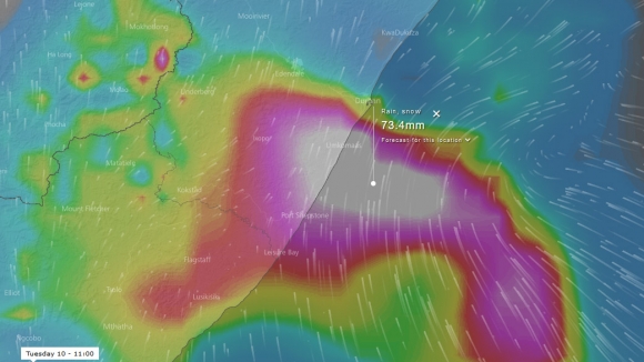
Tuesday 10 October 2017 Hurricane-force winds and 100mm of rain ripped through Durban this morning with devastating effect - at least six deaths and a huge container ship jammed in the harbour mouth, writes Spike.
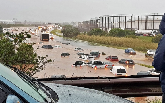
FLOATING CONVOY: The highway past the old airport was rather flooded. Photo Supplied
Durban surfer Mike Frew sent us some photos and told us about the mayhem. "Basically, we had a mild west blowing early today, followed by a light south, but from about 10am, BANG, we got 100mm of rain within half an hour and winds up to 67 knots. A category one hurricane is 73 kts, so this wasn't far off a full blown hurricane."
"Drains were blocked and cars floated down the highways outside the old airport near Amanzimtoti. Roofs were blown off. It was radical," Frew said.
Jason Ribbink, another Durban surfer, said that it's the worst and wildest weather he has ever seen in Durban. Reports are that at least six people have died: one drowned in a flooded river. Apparently a container was blown off a truck, landing on a car, instantly killing one occupant, while another was taken to hospital.
{youtube}u9RicziGFRs&t{/youtube}
There were reports of giant hailstones bigger than golf balls falling in the Maritzburg area. Social media has been choked with footage of the disaster, including a fair bit of fake news purporting to be from Durban, such as a video showing massive hailstones bombarding a domestic swimming pool, although this is believed to come from a strong storm that hit the highveld yesterday.
Patients from King Edward VIII hospital had to be moved after the roof collapsed. Motorists on Edwin Swales drive had to eventually swim from their cars after floodwaters failed to subside.
To top it off, a giant MSC container ship was blown sideways by the gale, which lodged it between the two breakwater walls of the harbour. A tug is stuck on the outside and another on the inside, and no ships can get in or out of Durban right now.
The flooding was caused by blocked drains that couldn't cope with the massive deluge, which has come from a cutoff low, common in transition periods between seasons. The cutoff low can be very powerful, permeatting all levels of the atmosphere above it. The rain has been falling heavily since the 10am blast, but not at the same volume.
Other places on the coast alaso got severe rain. For instance, 143mm fell in the Coffee Bay area. Expect the seas along the East Coast to be thick with brown water and debris washed out from inland areas.
SE gales out to sea are driving 10ft seas to shore north of Durban though some south in the direction has cut off the city from swell. However the storm detaches from the coast and moves away, so there are going to be solid 6' waves in town tomorrow Wednesday in clean SW winds.
Thursday has waves too, though smaller but consistent, and a strong S to SE wind smashes into the city from around 8 or 9am so the best window appears to be tommorrow, although that depends on now much has washed out from the rivers.
{gallery}SLIDESHOW/2017/october/durban-storm{/gallery}