


Purple People Eater
Tuesday 12 April 2011 A volatile purple patch of mutant mayhem is about to smack the South African coast, reports Spike, with torrential rain, galeforce winds and heaving swells emanating from a variety of sources in and around South Africa.
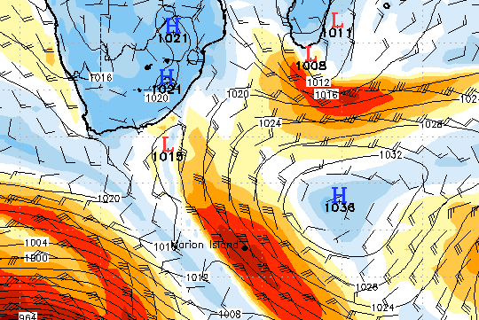
From tomorrow, Wednesday, a building east swell hits the East Coast, peaking on Thursday and Friday with sets of 10 feet or more. The macking east swell, caused by 50 knot gradient winds between a low pressure cell off Madagscar interacting with a large High to the south from Tuesday (today) to early Thursday, focuses on the area from Durban to southern Mozambique, with plenty big enough swell reaching into the Eastern Cape to overlay a whole bunch of deep ocean SW groundswell coming their way onThursday and Friday anyway.
The fat swell will be accompanied by a series of SW offshore busters but also periods of heavy rain.
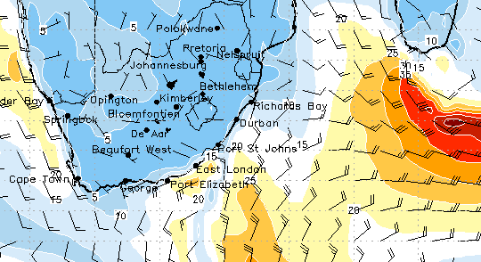
Wavescape warns of engorged rivers and brown seas along the Wild Coast and possibly the South Coast from Saturday after torrential rains over the southern Free State and Lesotho highlands on Thursday, Friday and early Saturday. Big rain in patches along the Wild and KZN Coast on Thursday, and also in Durban and on the North Coast on Friday afternoon.
To top off 2011's cyclonic crescendo to the East, a galeforce southeaster kaps the Western Cape on Friday, peaking Saturday up to 40 kts. The building wind arrives on Thursday at the same time as a macking 10-12' groundswell from another storm to the SW which is due to peak tomorrow, Wednesday, at 948 millibars around 1,500 miles SW of Cape Town.
This solid autumn swell peaks on Friday, continuing on Saturday by which time False Bay is filling up with an 8-10' windswell at 8 seconds from the fierce SE winds now blowing out to sea. The SE gale comes from a huge High pressure cell that moves into place below the SW Cape on Friday, registering at 1031 millibars by Friday evening, and hitting gusts of 40 kts on Saturday.
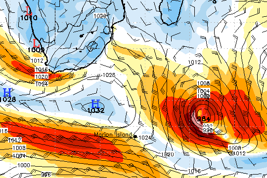
If that's not enough, this vicious High pressure then barrels along to the east on Thursday and Friday, intensifying as it grinds past the Southern Cape, dragging the staunch area of east wind with it, sucking towards the above Madagascan low as it seeps southwards. A strong High to the east of the storm, and the pushing High to the west of it (now 1032mb), are force-feeding the volatile little bugger, bloating it with energy, and it forms a proper cyclonic coil.
The low becomes re-energised all through Friday, and by Saturday morning at 8am (above) packs some serious punch, with hurricane force winds at a pressure of 984mb. The core fetch area early Saturday is pointing a long period groundswell straight at the coast between Durban and Mozambique, but all through Friday it's been spraying the East Coast with a series of pulses which arrive on Sunday and Monday.
The deepest part of the pulse from the above peak (literally the purple patch at the core of the wind) can be expected to peak late Sunday, early Monday with proper, long-lulled 15 to 16 second groundswell of 6-8' along the KZN coast and Mozambique.
Either way you look at it.
Waves.