


Earthquake hits Indo
Wednesday 2 March 2016 A powerful earthquake with a magnitude of 7.9 hit an area 500 nautical miles southwest of western Sumatra and the Mentawai Islands of Indonesia a short while ago.
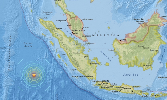
DEEP QUAKE: Map showing the location of the quake. Graphic US Geological Survey/EPA
The earthquake took place at 12:49:41 UTC in a deep area of the ocean up to 10 km. There have been no reports of damage or casualties. The shallower a quake, the more likely it is to cause damage, according to the National Meteorological Agency, who issued a tsunami warning for West Sumatra, North Sumatra and Aceh but later lifted it, said Reuters.
The epicentre was 808 km (502 miles) southwest of Padang, and was 10km (six miles) deep. The magnitude was orginally put at 8.2, and then 8.1, before it was lowered to 7.9.
According to news sources, about 1,000 Mentawai residents were at a tsunami evacuation shelter.
The earthquake was felt in many cities and areas, even as far as Singapore.