BOOM! BOOM!
Monday 10 February 2014 A double boom-box in the deep thumps out radiating rings of marine mayhem bearing down on Cape Town from Saturday, and a four-day window looks set to bring a Big Wave World Tour green light, writes Spike.
There can only be one .... not
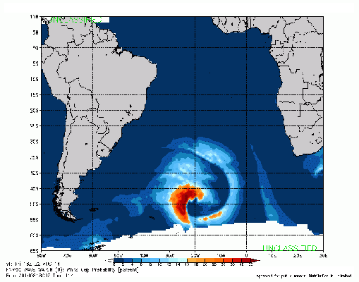
At first, it looked like one ginormous mother of a storm that peaked on Thursday almost on the Antarctic ice shelf. By Thursday 8pm, this storm had mutated into a belting burst of hurricane force wind seething around a 934mb low pressure centre 2,300 miles from Cape Town - easily the most powerful storm of the winter.
By Friday morning 8am, it had reached a ferocious peak while advancing to a point 2,000 nautical miles from Cape Town. Core pressure remained 940mb, and the hurricane was still exploding.
My calculations showed ETA Monday morning. Giant. Yeah man. It elicited excited binary chatter with the ASP across the Interweb.
But, damn it, local forecasts indicated that the advance frontal guard of the giant storm would slice Cape Town up by Sunday night with the forerunner NW winds of the storm, and these would blow Monday and Tuesday away. Nooooit! The forecaster's nightmare.
So, despite this beautiful angry boil on the planet's surface showing steady virulance, and pustilating consistence, the dratted Weather Gods had intervened (at an admittedly early stage eight days out yesterday).
But lo! And Behold! Today, we woke up to another seething morass of deep-ocean hatred that begins to spew salty vitriol from tonight when genesis takes place 3,300 miles in the furthest possible corner of the Atlantic by Cape Horn - where Poseidon sends unruly nymphs and mermaids to think on their transgressions.
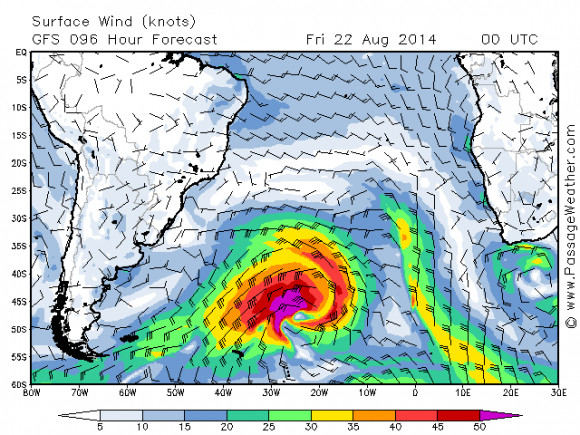
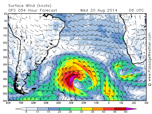
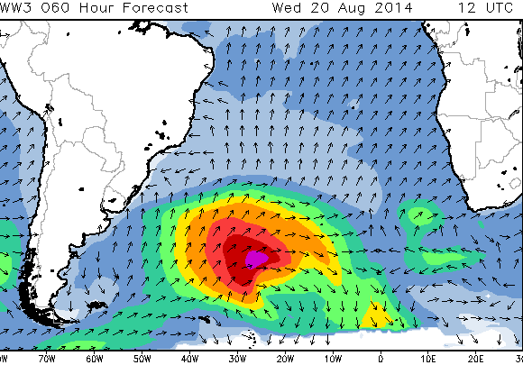
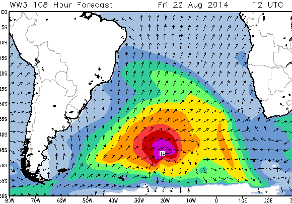
If we are to believe this hot-off-the-press spawning by the deity Wave Watch, this storm, which now elevates to Number One in our sights and relegates Friday's storm to Number Two, sighs into being this afternoon. By this evening she begins to rumble relentlessly over the Falkands and into the open ocean. By tomorrow evening, she exhibits incredible fury across a fearsome fetch (although a tad smaller than Storm #2 on Friday's peak).
By Wednesday noon, she peaks ferociously in a screeching climactic tumult about 1,800 miles away. By Wednesday midnight, the last sputter of firework embers drift down to the sea surface through the inky night, and an epic long period proper pulse is sweeping through the ocean.
Core swell heights in her peak on Wednesday show 12 metres or more, smashed by 60kt+ winds, while our second storm at her peak on Friday indicates 15m or more in winds of 70kts, suggesting the second swell will be bigger, particularly since the second swell forms closer to Cape Town and blows for longer.
The first signs of this swell are felt on our shores late Friday and early Saturday.
Expect a beautiful 15-18 foot swell increasing all day Saturday in epic winds. And Sunday looks proper big 20ft+ yes. On and so does Monday. That's right. The second swell has arrived with 20ft+ or bigger sets, maybe some to 30 or more. Oh ja. And Tuesday is grinding off its tits too. Terwitt ter whoo.
It's almost like this week's heads up, the Tuesday storm, cleared a path for two twin orcs to lumber in behind the recce division. It's like the current storm has shoved the pestilent High pressure out of the way, to open the door for more mayhem, wailing and gnashing of teeth.
Unfortunately, the weather gods have decided, at this early stage, to time the arrival of the swell on Monday with a staunch spurt of NW winds from the storm that created the swell. But the bonus for us is that the weather gods have also decided to give us superb conditions for the first two days when the first swell arrives, on Saturday and Sunday.
Get ready for something rather special.